
Elevate Your Fishing Game: The Ultimate Guide to Marine GPS Apps and Devices for 2025
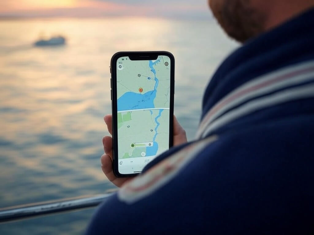
Fishing in 2025 is more than just dropping a line—it’s about having the best technology to make every trip productive, safe, and enjoyable. Marine GPS apps and fish-finding devices have become essential tools, offering features like waypoint marking, depth mapping, and even live fish tracking. Whether you’re a recreational angler or a seasoned pro, these tools can revolutionize the way you fish. Let’s explore the best marine GPS apps, devices, and the exciting future of this technology.
Why Marine GPS Apps Are a Must-Have for Anglers
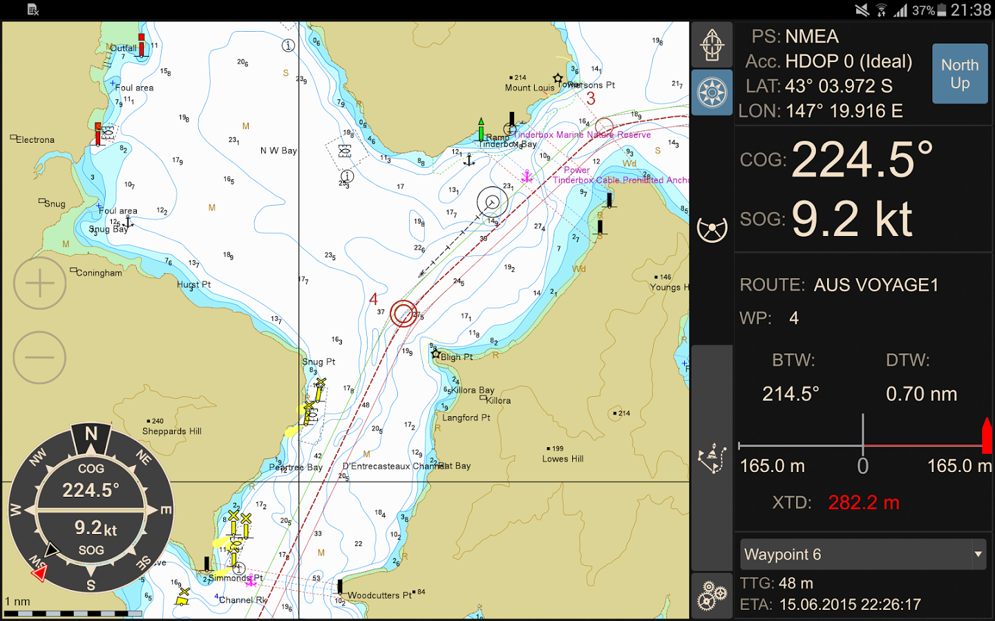
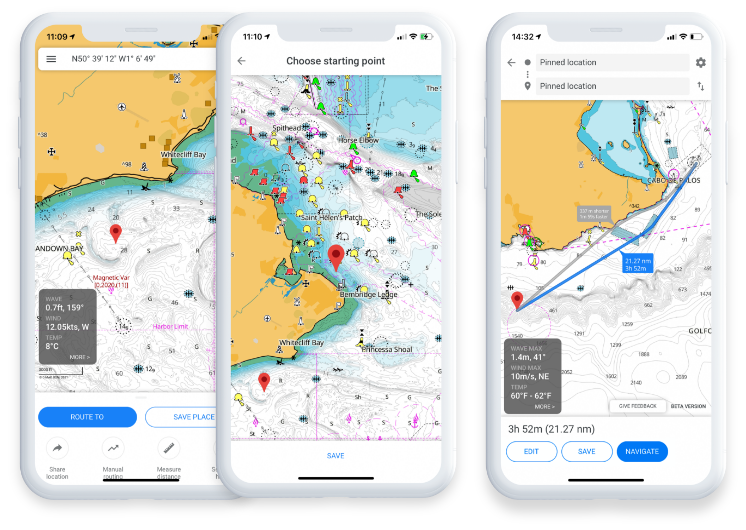
Fishing success isn’t just about patience—it’s about preparation. With marine GPS apps, you can do everything from planning routes and tracking tides to marking fishing hotspots and logging catches. Imagine having a tool that combines sonar integration, depth charts, and real-time weather updates—all at your fingertips. These apps aren’t just useful; they’re essential for modern anglers.
Here’s what makes them indispensable:
- Find Fish Faster: Use sonar and real-time tracking to pinpoint schools of fish.
- Plan Smarter Trips: Tools like tidal and current tracking help optimize fishing times.
- Stay Safe on the Water: GPS apps with AIS integration and weather alerts keep you prepared for unexpected conditions.
Now let’s explore the top apps making waves in 2025.
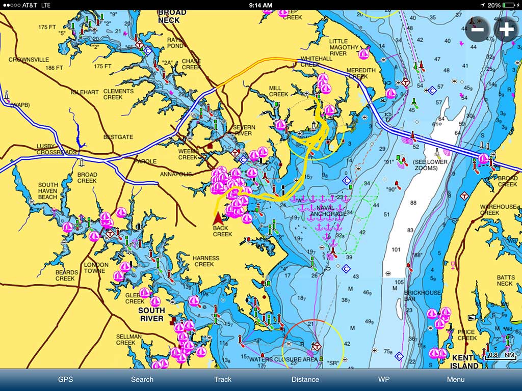
The Best Marine GPS Apps for Fishing in 2025
With so many apps available, it’s important to know which ones deliver the best features for your needs. Whether you’re mapping new spots or competing in tournaments, these GPS apps offer something for every angler.
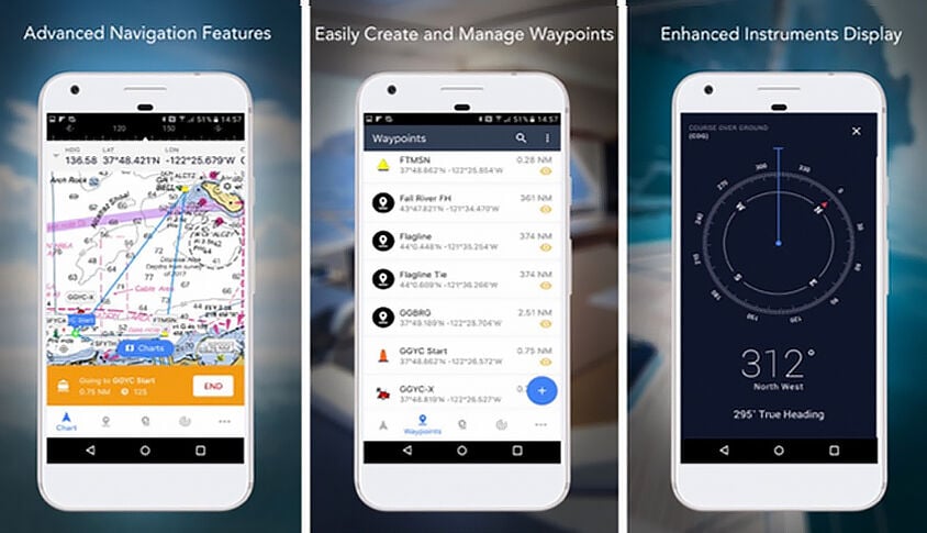
1. Navionics® Boating App
Navionics remains a favorite for its versatility and depth of features.
- Top Features:
- Depth mapping, tidal tracking, and waypoint marking for precise fishing.
- Real-time weather forecasting to plan safer trips.
- Auto-routing to get you to fishing hotspots efficiently.
- Best For: All-around fishing and navigation, perfect for both recreational and professional anglers.
2. iSailor
The iSailor app delivers professional-grade tools for serious fishing enthusiasts.
- Top Features:
- High-resolution charts and AIS integration for safety.
- Advanced waypoint tools to mark and revisit fishing locations.
- Detailed tidal and current data for strategic planning.
- Best For: Tournament anglers and professionals who need high-precision tools.
3. C-Map
C-Map is a user-friendly app packed with powerful fishing tools.
- Top Features:
- Depth contour mapping and water temperature tracking.
- Tide and current overlays to optimize fishing strategies.
- Community fishing spots for shared insights.
- Best For: Casual and professional anglers looking for intuitive tools.
4. iNavX
The versatile iNavX app is perfect for anglers who need global coverage and advanced features.
- Top Features:
- Sonar integration and advanced waypoint marking.
- Catch logging to track your fishing success.
- Comprehensive route planning tools for longer trips.
- Best For: Competitive anglers and those fishing in varied environments.
5. Argo
Argo offers a unique social approach to fishing, perfect for connecting with other anglers.
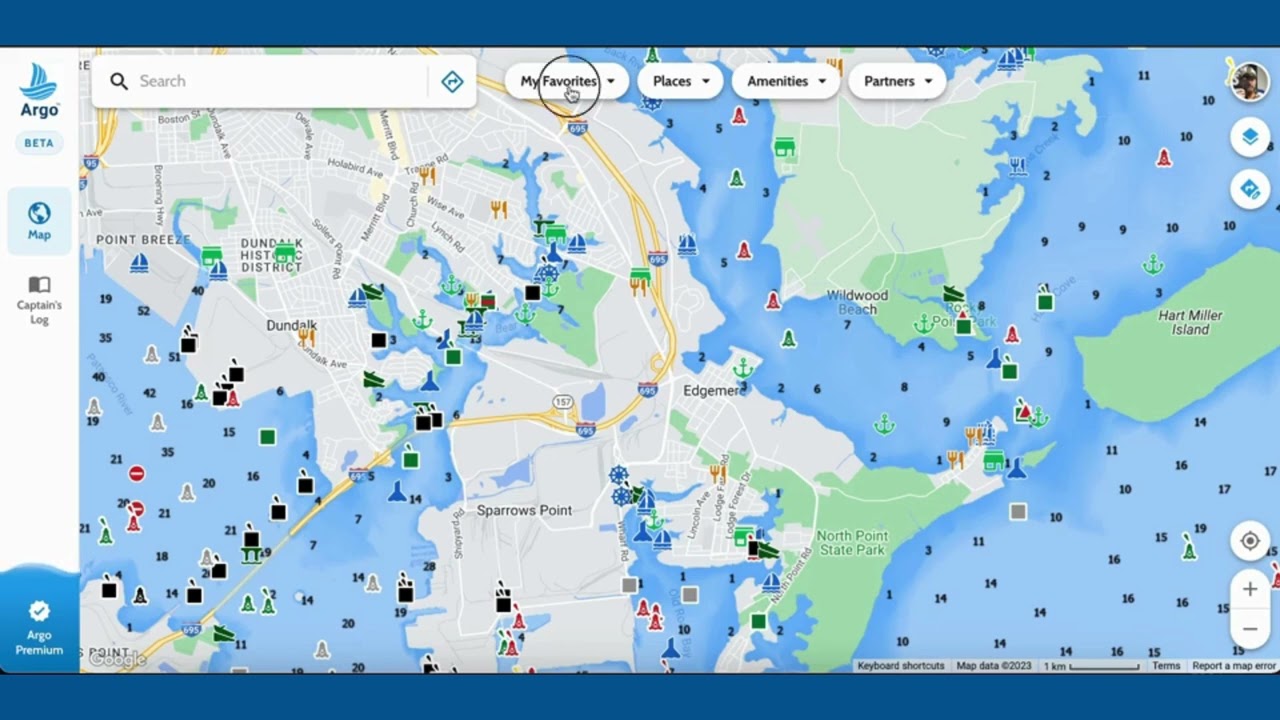
- Top Features:
- Shared fishing spots and real-time water temperature tracking.
- Easy buoy placement tools for marking fishing zones.
- Social integration for sharing insights and tips.
- Best For: Recreational anglers who enjoy a community-driven experience.
Key Features Every Angler Should Look For
Choosing the right GPS app means focusing on features that match your needs. Here are the essentials to keep in mind:
- Fish-Finding Tools: Apps with sonar integration show fish activity and underwater structures in real-time.
- Depth Mapping: Contour charts help identify ledges, drop-offs, and other productive fishing spots.
- Tidal and Current Data: Track water movement to improve your chances of success.
- Waypoint Marking: Save and organize fishing hotspots for easy access later.
- Catch Logging: Record details about your catches, including size, species, and location.
- Weather Alerts: Stay safe with apps that provide real-time storm warnings and weather updates.
- Regulation Overlays: Avoid penalties with maps that show fishing zone boundaries.
These tools aren’t just convenient—they’re game-changers for anglers who want to fish smarter.
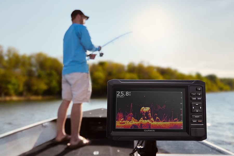
Top Fish Finder GPS Devices
If you’re ready to upgrade your gear, these GPS and fish-finding devices deliver exceptional features tailored for anglers. From portable options to advanced systems, here’s a look at the best devices for 2025:
| Device | Features | Best For |
|---|---|---|
| Garmin Striker 4 | Dual-beam transducer, CHIRP sonar, waypoint marking, sonar history rewind, built-in flasher. | Anglers needing basic fish-finding. |
| Garmin Striker Cast | Castable sonar, smartphone connectivity, QuickDraw mapping, water-resistant, 10-hour battery. | Portable fishing and mapping. |
| Garmin ECHOMAP UHD2 93sv | 9″ touchscreen, ClearVü/SideVü sonar, Navionics+ maps, LiveScope compatibility. | Advanced fishing and navigation. |
| Humminbird HELIX Series | MEGA Side Imaging, CHIRP sonar, AutoChart LIVE mapping, large display. | High-detail imaging and mapping. |
| Lowrance HDS PRO 10 | High-resolution sonar, advanced mapping tools, customizable display. | Professional-grade fishing. |
The Future of Marine GPS for Anglers
Marine GPS technology is evolving rapidly, delivering smarter, safer, and more integrated tools for anglers. Here’s what’s on the horizon:
- Precision Positioning: Tools like Minn Kota’s Spot-Lock allow for exact boat positioning, letting you stay over productive fishing zones without using a physical anchor.
- Fish-Finding Integration: Devices like the Humminbird Helix 5 Chirp GPS G3 combine GPS and sonar to create detailed underwater maps in real-time.
- Satellite Communication: Satellite messengers and monitoring systems like Yamaha’s Siren enable two-way communication and vessel tracking from remote locations.
- Advanced Radar and Imaging: Systems like Garmin’s GMR xHD3 radar combine GPS with high-definition imaging to enhance navigation and locate fish-rich areas.
- Automated Fishing: GPS-enabled bait boats and route automation are making precision fishing easier and more effective.
- Safety Enhancements: Emergency tools like the McMurdo SmartFind G8 AIS EPIRB offer better alerting, tracking, and recovery capabilities.
With these innovations, the future of fishing looks smarter, safer, and more productive.
Frequently Asked Questions About Marine GPS Apps and Devices for Fishing
If you’re considering marine GPS apps or devices for fishing, you likely have questions that go beyond the basics. Here’s a helpful FAQ to cover common concerns and provide actionable insights.
Can I use my smartphone as a marine GPS?
Yes, many marine GPS apps are designed for smartphones and tablets. Apps like Navionics, C-Map, and iNavX turn your device into a powerful navigation tool. Keep in mind that smartphones rely on internal GPS, which may not be as accurate as dedicated marine GPS devices, especially in areas with poor signal.
Do I need an internet connection for marine GPS apps?
Most marine GPS apps, such as Navionics and C-Map, allow you to download maps for offline use. This is especially useful when fishing in remote areas where cellular service is unreliable. However, real-time features like weather updates and live fish tracking may require an internet connection.
How do I integrate my GPS with a trolling motor?
Many GPS devices, like the Garmin ECHOMAP UHD2 and Lowrance HDS PRO 10, offer integration with trolling motors. Features like Minn Kota’s Spot-Lock allow you to anchor your boat precisely without a physical anchor. Check your trolling motor’s compatibility with your GPS system before purchasing.
What’s the difference between CHIRP sonar and traditional sonar?
CHIRP (Compressed High-Intensity Radiated Pulse) sonar provides a clearer, more detailed image of underwater structures and fish compared to traditional sonar. Devices like the Garmin Striker 4 and Humminbird HELIX Series use CHIRP sonar to help anglers locate fish more accurately.
Are marine GPS apps suitable for small boats or kayaks?
Absolutely! Portable options like the Garmin Striker Cast or apps like Navionics are ideal for small boats and kayaks. They offer easy setup, smartphone connectivity, and lightweight designs, making them perfect for compact watercraft.
Can marine GPS devices track fish movement in real-time?
Yes, some advanced systems like the Humminbird HELIX Series and Lowrance HDS PRO 10 integrate with sonar to provide real-time fish activity tracking. These tools show fish locations, depths, and movement, helping you target the best spots.
How do I save fishing hotspots on my GPS?
Most GPS devices and apps have waypoint marking features that let you save specific locations. For example:
- On Navionics, you can create waypoints directly on the map.
- Devices like the Garmin Striker 4 allow you to save and name hotspots for easy access later.
What are regulation overlays, and why are they important?
Regulation overlays display restricted fishing zones, marine protected areas, and local rules directly on your GPS map. This feature, found in apps like C-Map, helps anglers avoid penalties and ensures compliance with environmental laws.
How do I choose between a marine GPS app and a standalone device?
- Choose a GPS app if you prefer portability, cost-effectiveness, and smartphone integration.
- Opt for a standalone device if you need advanced features like CHIRP sonar, detailed radar imaging, and precise control for trolling motors.
For serious anglers, combining both tools can provide the best of both worlds.
Are there GPS tools specifically for fishing tournaments?
Yes, many GPS apps and devices cater to competitive anglers. Features like waypoint marking, real-time fish tracking, and detailed charting are especially useful in tournaments. Devices like the Lowrance HDS PRO 10 and apps like iSailor are popular choices for their professional-grade tools.
Can marine GPS tools help in emergencies?
Absolutely. Devices like the McMurdo SmartFind G8 AIS EPIRB provide GPS-enabled emergency alerts, allowing authorities to locate and rescue you quickly. Many GPS apps also feature AIS integration to help track nearby vessels and improve safety.
What’s the lifespan of a marine GPS device?
Most marine GPS devices are built to last 5-10 years or more, depending on care and usage. Regular updates to software and maps are crucial to keep the device functioning effectively. Waterproofing and rugged designs help extend their durability.
How often should I update my GPS maps?
It’s recommended to update your maps at least once a year, especially for areas with changing underwater structures, new hazards, or updated fishing regulations. Many apps, like Navionics, provide regular updates for a subscription fee.
Can I connect multiple devices to my GPS system?
Yes, many advanced GPS systems support connectivity with multiple devices. For example, Garmin’s devices can link with smartphones, trolling motors, and sonar tools for seamless integration. Check your system’s specifications for connectivity options.
Take Action and Upgrade Your Fishing Experience
If you have other questions or need help choosing the right GPS tools, feel free to ask or explore these options in detail. With the right tools, your fishing trips will be safer, more productive, and far more enjoyable!
The right marine GPS app or device can transform your time on the water, helping you fish smarter, stay safe, and enjoy every trip to the fullest. Whether you’re using Navionics to plan your route, the Garmin Striker Cast for portability, or the Humminbird HELIX Series for detailed imaging, there’s a tool to fit your needs.
What’s your go-to GPS app or device? Share your experiences and tips in the comments below. Let’s help every angler find their edge in 2025!